EarthReplay

Personalised satellite timelapse · From $29

Give them the place
that made them.

A satellite timelapse of the one place that matters most — the family farm, the street they grew up on, where it all began — changing across the decades. In their inbox within 48 hours.

Make their video · From $29Delivered within 48 hours · Refundable

$29 anywhere on Earth · $59 close enough to see your own roof

  • A 30-second 1080p vertical video, made to share
  • An AI-written story of how the place changed
  • A shareable interactive before/after page

A real up-close EarthReplay timelapse — Austin, Texas · 0.6 m aerial

How it works

From a point on the map to a video in your inbox.

Three steps. Everything else — pulling 40 years of satellite scenes, denoising clouds, writing the story — happens on our side.

  1. 01

    Pick a place

    Drop a pin on the satellite map. Choose the scale: a whole region, a city, or a tight neighborhood. We tell you upfront how much clear imagery exists.

    Under 2 minutes

  2. 02

    Pay from $29

    $29 for the wide timelapse, $59 to see your own house up close — in USD, Stripe-secured. Full refund within 24 hours if anything looks off — no questions.

    Stripe-secured

  3. 03

    Receive the video

    We pull every clear Landsat or Sentinel-2 scene, denoise the clouds, stabilise the frames, and write a 3-sentence story. Delivered as a 1080p MP4 plus an interactive viewer link.

    1 – 48 hours

Auckland, New Zealand · 5 cm aerial · since 1940

What makes it different

Zoom all the way in — to your own roof.

Every other map gift stops at the city. EarthReplay keeps going. Where coverage allows, we render your place from sub-metre aerial photography — close enough to make out the house, the barn, the trees someone planted — changing across the years. It's the difference between “a satellite picture” and “that's home.”

Available up close in the United States (0.6 m) and New Zealand (5 cm, back to 1939) — more countries coming. You'll see the exact years available for your spot before you pay.

Try before you buy

Drag the slider — imagine your place.

A real example of the satellite timelapse you'll receive. The slider auto-animates until you grab it.

2024
1986
19862024

Phoenix, Arizona

19862024

Suburbs spread across former farmland and desert over four decades.

  • Population grew

  • Built area grew

  • Farmland shrank

Examples

Every kind of change, anywhere on Earth.

Tap any card to flip between past and present. Real Landsat imagery.

What you also get

A short story for every place.

We pair every video with a 3-sentence written explanation of why the place changed — drawn from public data and observable change in the imagery. It's the part friends quote when they share your video.

Sample · Phoenix, Arizona · 1984 – 2024

From farmland to one of the largest U.S. cities

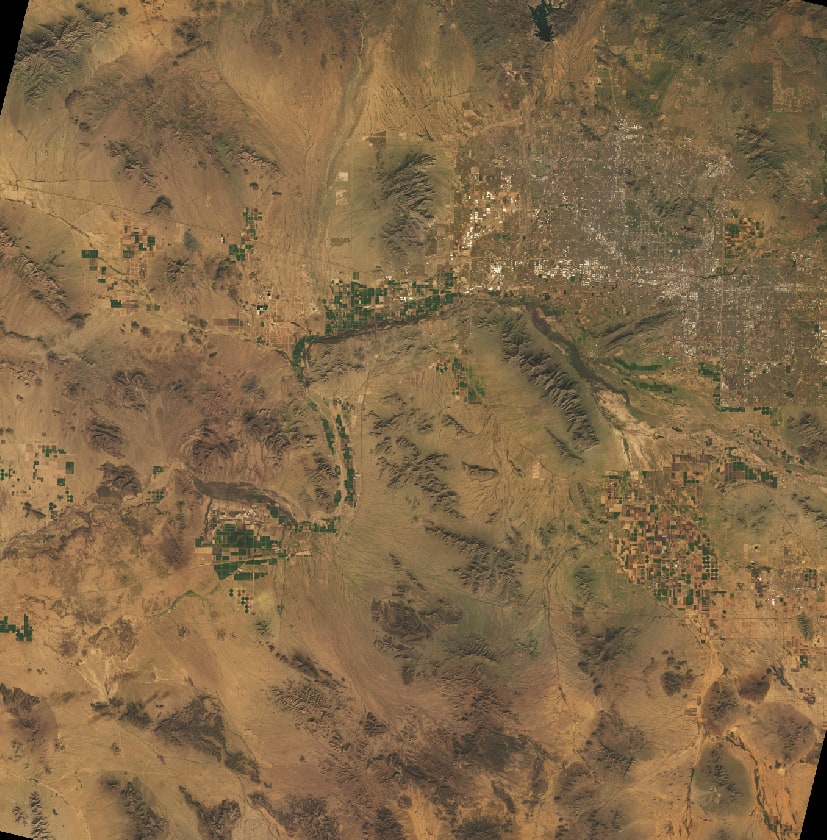
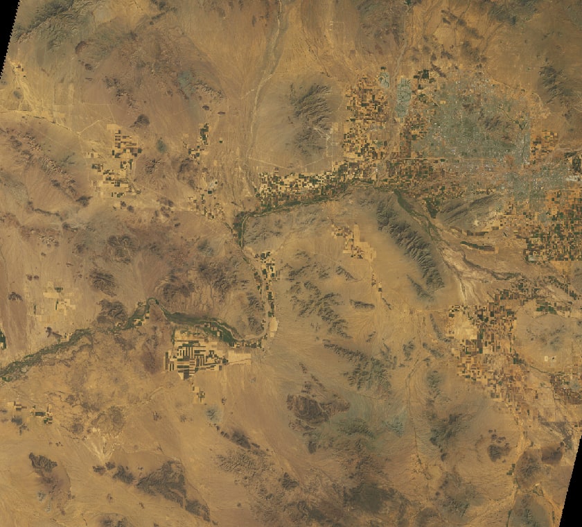
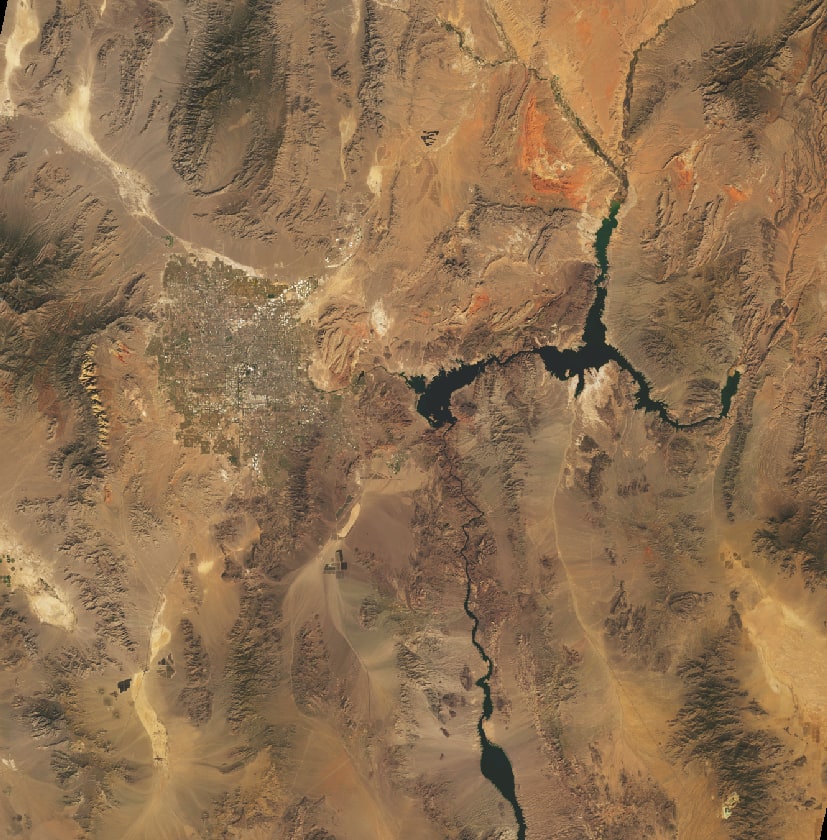
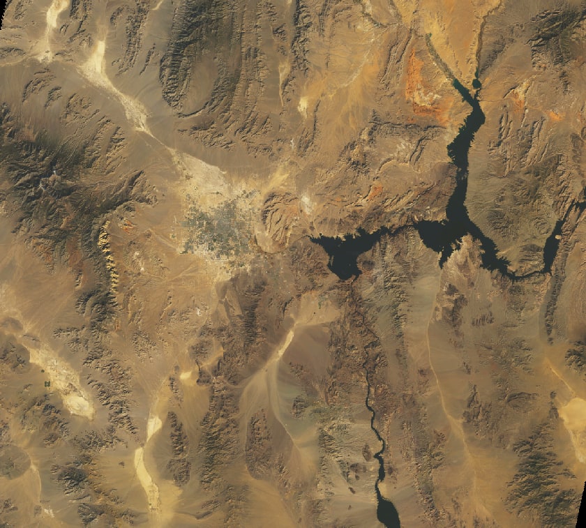
In 1984 Phoenix was ringed by irrigated cotton and citrus farms. Decades of suburban growth — driven by air conditioning, water from the Central Arizona Project, and sun-belt migration — replaced much of that farmland with subdivisions and freeways. Today it is one of the largest and fastest-warming cities in the United States. (Illustrative of the kind of story we write — your video's story is drawn from your location's own data and imagery.)

  • Rapid population growth
  • Sprawling built area
  • Warming summers

Give a place

Give someone their history.

The childhood home. The family farm. The street where they grew up. A quiet, specific gift for a parent, a partner, or a friend — delivered to their inbox with your message.

Order as a gift →

From $29 · No extra cost to gift · Delivered with your message

What you get

Every order, the same four things.

FAQ

Questions, before you order.

Where does the imagery come from?
Public-domain Landsat (since 1984, 30 m/px) and Sentinel-2 (since 2015, 10 m/px), processed through the Microsoft Planetary Computer — the same data NASA and ESA use. For the up-close tier we add open national aerial archives where they exist: USDA NAIP in the United States (sub-metre) and LINZ in New Zealand (5 cm, back to 1939). We polish it all into a watchable 30-second video.
How long until I get the video?
Most renders finish within 1 – 6 hours of payment. Guaranteed within 48. You'll get an email with the viewer link and an MP4 download the moment it's ready.
How sharp will my video be?
It depends on the place and tier. Landsat (30 m/px) shows regional landscape change; Sentinel-2 (10 m/px) shows street layouts and neighborhood patterns. Where our up-close tier is available (currently the US and New Zealand) we use sub-metre aerial photography — 0.6 m or sharper — close enough to make out individual buildings, yards and trees. You'll see real sample frames and the exact resolution for your spot before you pay.
What if I don't like the result?
Reply to the delivery email within 24 hours. We re-render with a different framing, or refund in full. Either way, no quibbling.
Can I send one as a gift?
Yes — tick the gift checkbox at checkout. The recipient gets the video email with your personal note; you get a separate buyer receipt. Same price, no gift surcharge.
Does it work anywhere on Earth?
Almost. We cover everywhere between 81° N and 81° S — that's everything except the deep polar caps. If your spot has too much persistent cloud cover for a clean timelapse, we'll tell you before you pay.